
SOLUTION
Considering the ever changing environment of Brisbane, we want to propose a solution that is guided by the concept of “Building with Nature”. Our intention is to integrate several existing ecosystem-based strategies into a system and implement them as a whole to maximize the benefits. The main goal is to preserve the natural environment and add more green spaces. The ecosystem-based strategies and methods aim to offer solutions in a way that makes engineering and design more sustainable, cost-effective, more adaptable, and resilient. Many of the current approaches are either time-consuming to build or vulnerable to stand in a long time frame. Orienting the solution around “Building with Nature ” will allow cities to alter such disadvantages and become water smart. As the field of water management is taking steps towards eco-friendly projects like green/blue infrastructures, our group also believes that the challenges facing Brisbane City can also be potentially solved by the “Building with Nature” system.
SOLUTION – Coastal Buffer Zone
Under this system, the first strategy will address flooding, sea-level rising and consequences of sea-level rising like storm surge, coastal recession as well as erosion. It is clear that Brisbane cannot avoid sea-level rising or flooding. Hence, preparation should start immediately to protect Brisbane from potential harms. Given the fact that the conventional strategies like a seawall, floodwalls, dikes have already taken place in Brisbane, we would recommend a method called the coastal buffer zone. A coastal buffer zone, or “inlaag” in Dutch, is a contiguous area of vegetation bordering a coastal shoreline feature19. Usually, this area is a predominantly brackish zone along the coastline which may not be suitable for high-quality land use like housing because of destabilization. Thus, it makes sense to redevelop these areas into green spaces and to accompany the seawalls and dikes that can only do partial protection to the coast, coastal buffer zones should be introduced to places that are facing overland runoff, erosion, and storm damage.
To build a coastal buffer zone will require operators to place specific vegetation in this area to hold sediment in place, in which case, to stabilize the coastlines. These vegetation are capable of absorbing water, then reduce erosion caused by runoff. They are also able to break the impact of raindrops or wave-splash, and physically slow and disperse the speed of water flow from storm surge20. The plant roots also bind and secure soils and help improve the stability of the coastal buffer zone. Other functions include provide food and habitat for wildlife and add visual aesthetics21.

Figure 3. Typical Buffer Zone Cross Section22
As for the selection of plants, the vegetation being placed in the buffer zone should be tolerant of salt spray and exposure to wind and waves like all kinds of beach grass with strong and fibrous root systems. The roots of beach grass would allow them to establish on the shore quickly and steadily. Besides the beachgrass, other categories of vegetation include beach plum, bayberry, eelgrass, sweet fern, and bearberry. It is even better for Brisbane to grow Australian native plant species because they will be more comfortable with the coastal soil23.
The ideal practice of the coastal buffer zone would need an area that is between two existing dikes with the primary dike functioning as the one to stop high waters and the second one being the fence to stop water further inundating the inner land. It is also very common to plan the coastal buffer zone right along the edge of the shore. But this option will require efforts to regrade the bank to slope inland. For Brisbane, the coastal buffer zones can be constructed both along the Moreton Bay and Brisbane River24.

Figure 4. Coastal Buffer Zone Vegetation25

Figure 5. Dutch Model for Coastal Buffer Zone26
The group believes that this strategy should start immediately along with other smart water strategies that have been developed in Brisbane. It might take up to 10 years to fully implement one coastal buffer zone. The process includes site selection, property, and rezoning, removing existing but unwanted things on the land, planting the selected vegetation, and placing other aquaculture and saline crops. It is critical to choose an appropriate time of year (generally spring or fall) to plant the vegetation, and carefully follow the specific instructions for watering, fertilizing, and maintenance. If the dike style coastal buffer zone is built, then public recreation spaces can be offered for pedestrians and cyclists. The trails will be built in floodable materials to prepare for emergencies. If the space is big enough, one could consider developing potential aquaculture farming in the coastal buffer zone. Shellfish, ragworms, seaweeds, and glassworts are all very profitable products that are very adaptable to salt water27.
Furthermore, this strategy has been practiced in multiple countries and several cities, for example, the Netherlands, Belgium, Denmark, Germany, Netherlands, and the United Kingdom28. In Queensland, similar projects like vegetation zoning and wetlands preservation have also taken place. We believe that this is a feasible strategy to practice in Brisbane. As for funding resources, the Brisbane government will be able to apply for both state grants and federal grants. One reliable source is the Queensland Government’s QCoast 2100. In partnership with the Local Government Association of Queensland, the Queensland Government will invest $12 million to help coastal councils and their communities plan and prepare for storm tide, coastal erosion, and rising sea levels resulting from climate change29.
The impact of coastal buffer zones for ecosystems is relatively low compared to hard infrastructures. However, one significant consequence could be that by removing the open sand areas and transforming it into vegetation cover, some species who prefer a sandy environment would lose their habitats. Other impacts on the environment might be potential water quality degradation due to excessive fertilizer usage that used to grow the vegetation. Therefore, the amount of the fertilizer must be strictly controlled and supervised. Moreover, the creation of a coastal buffer zone might cause rezoning of the area, which will require extra efforts from planning department to enhance their original plans.
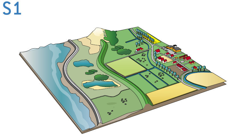
Figure 6. Model for Coastal Buffer Zone30
SOLUTION – Rain Bank
The other aspect of the “Building with Nature” concept would be to install rain bank underneath major parklands in Brisbane. As an innovative but mature stormwater harvesting technique, rain bank has demonstrated a list of advantages which can address some of the pressing water-related challenges in Brisbane such as flooding, stormwater runoff, increasing sedimentation, and water scarcity. The advantages are31:
- Provide a new source of water which could be used to top-up water features of the park and secure the supply of non-potable water under drought condition.
- By installing rain banks under green space along the riverfront, stormwater that carries dirt and pollutants from a highly urbanized area can be captured and treated before it runs into the River and leads to water contamination or increasing water turbidity.
- Part of the design of rain banks is a large window into the treatment plant, which can encourage visitor interaction as well as educate them on how rain bank works and the importance of water conservation.
- Rain bank is connected to the existing stormwater system and treated water distribution pipes (the ones that transfer treated water back to the park for uses such as irrigation/toilet flushing/landscaping), which makes the idea of rain bank more economically feasible.
- The price for rain bank to generate treated water is at $1.4 to $1.6/KL, which is significantly lower than the price of local water utility provider’s potable water at $4.2/KL or tinkered water at $20/KL.
- The rain bank is located underground and will not bring any impact on the precious open space of the city.
- The weir inside SHIP (Stormwater Harvesting Interception Pit) can stop contaminated water from entering Brisbane River and accidental spills that occur in the catchment.
- If the City can coordinate with the local organizations to install rain bank along the Lockyer Valley, the upper stream of Brisbane River, it can also be a relief of the increasing sediment that caused by the unvegetated riverbank of the upper stream. (But land-use control and planting more trees can be a more cost-effective alternative there.)


Figure 7 & 8. Site Maps of South Bank Parkland32
Rain bank is a feasible solution for Brisbane because the city already has one that was put into practice. It has a relatively clear structure regarding stakeholders and funding sources which enables its success to be duplicated and implemented in other suitable major parks within the city. The existing one in Brisbane is within the South Bank Parkland, which is a park located on the south banks of Brisbane River, across the river from CBD. The South Bank Park is a 17.5-hectare public park which opens all year round and has attracted 11 million people every year. It contains multiple landscape spaces including swimming pools, water play areas, rainforest walks, etc. These water feature spaces, in addition to the irrigation and toilet flushing, use up approximately 90 ML/year of non-potable water. The park also needs 120 ML of potable water a year for tourist consumption.33

Figure 9. Site Maps of Rain Bank, SHIP, and Its Catchment34
Under the park, there is a rain bank. It is a stormwater harvesting system with a small rain treatment plant and a 6 x 50,000 L water storage tank. Stormwater runoff generated from the park and a highly urbanized 30-hectare catchment in southwest Brisbane (adjacent to the park) is directed to the rain bank and being treated there. This project is using the existing stormwater catchment/pipes so little or no additional pipe system is required. As indicated in the map above, a key feature to this system is the SHIP35 (Stormwater Harvesting Interception Pit) which contains weir to “stop tidal river water from entering the system and to intercept and hold stormwater flowing from the upstream catchment in the pipes so it can be pumped to the main storage rank.” The SHIP also has a probe that monitors the water level and the quality of water at the weir. If the water quality is lower than the capacity of what the treatment can take, the pump will be turned off, so water does not enter the raw water storage tank.
Once water is collected, the treatment plant in rain bank removes any particles, bacteria, or viruses in the water. Then the water is stored and ready to be used for on-site uses such as irrigation and water for the swimming pool. This system capture stormwater runoff at volume 77 ML/year and pool backwash water at 32 ML/yr. The number adds up to 109 ML per year which exceeds the 90 ML/year of non-potable water demand of the South Bank Parkland.36 Even only counting stormwater runoff at 77 ML/year and leave alone the pool backwash water, rain bank can provide 87% of the South Bank Parkland’s irrigation and water features demand.37 Since 2004, local government has regulated the availability of potable water for park’s irrigation use due to droughts. The rain bank allows the limited amount of rainwater to be collected during a drought year and enable the parks to be self-sufficient.
In conclusion, rain banks is a feasible solution for Brisbane with multiple functions including allowing the park to be self-sufficient in water, provide a buffer between the river and built environment, and prevent stormwater runoff. Additionally, the park can also have a place where part of the underground treatment plant is shown to educate citizens. And these functions help to tackle the water-related issues we identified earlier including water scarcity, sea-level rise, and flooding.
This solution might also have some negative impacts. A hinged tide gate was installed to prevent excessive backflow of tidal river water. It is successful in blocking backflow but “the wash generated from the CityCat ferries in the River was causing the gates to open occasionally” which allows the inflow of saline water into the plant. Additionally, rain bank is a practical solution for new parks, but not so much for developed urban areas. This is because the nature of rain bank as an underground infrastructure can make it hard to implement in the built areas due to the economic cost and the possibility of relocating people. Another challenge is that to develop this rain bank, South Bank Corporation was established. Its role is crucial for success because it acts as the organization to assemble stakeholders and to manage contractors to deliver maintenance for the infrastructure. In this case, if implementing the rain bank in other locations, deciding or forming a corporation to take the lead of development and management is important. 38
But even with the challenges and downsides, the group still believes rain bank is a viable solution that should be implemented now in major parks of Brisbane. Some possible locations for implementation include Brisbane City Botanic Garden, Kangaroo Point Cliffs Park, CT White Park, Captain Burke Park, New Farm Park, Mowbray Park, and Hemmant Recreation Reserve. The locations listed share some common characteristics. For instance, they are all located along the Brisbane River and adjacent to the highly urbanized area; they all have an existing organization which provides management of the site, and they are already developed and installing rain bank will not bring the problem of relocation.

Figure 10. List of Key Stakeholders of South Bank Rain Bank39
The figure shown above is a list of stakeholders in the South Bank Parkland’s Rain Bank project. This list could serve as a reference for the rain banks being constructed in the future. The South Bank Rain Bank is collectively funded by Queensland State government ($4.7 million), Federal government ($3.3 million), and South Bank Corporation ($1.5 million).40 Regarding the time frame, the City started to brainstorm for water management ideas since 2004 and finished the rain bank concept by 2008. The design was finalized in 2009. Construction started in February 2010 and the park is officially opened in October 2010.41 In total, the project took 6 years. If replicating the model to other parks, the new project can be built off the idea of this rain bank instead of creating from scratch. In this case, the group believes that even with the beginning preparation work including site selecting, local water pipe investigating, and monitoring, forming key project teams, the time frame would be shortened than 6 years.
REFERENCE
- Brisbane City’s Water Story: https://iwa-network.org/wp-content/uploads/2016/12/FINALCWS-Approved-by-Brisbane-City-Council.pdf
- Figure created by the group. GIS shapefiles from: Brisbane Open Data, https://www.data.brisbane.qld.gov.au/ and Queensland Open Data Portal, https://www.data.qld.gov.au/dataset.
- Hengyu and Zining, Assignment 1.
- “The 2011 Brisbane Floods: Causes, Impacts and Implications” (2011): https://www.mdpi.com/2073-4441/3/4/1149/htm
- “The 2011 Brisbane Floods: Causes, Impacts and Implications” (2011): https://www.mdpi.com/2073-4441/3/4/1149/htm
- “The 2011 Brisbane Floods: Causes, Impacts and Implications” (2011): https://www.mdpi.com/2073-4441/3/4/1149/htm
- “The 2011 Brisbane Floods: Causes, Impacts and Implications” (2011): https://www.mdpi.com/2073-4441/3/4/1149/htm
- “Recent Rainfall, Drought and Southern Australia’s Long-Term Rainfall Decline” (2015): http://www.bom.gov.au/climate/updates/articles/a010-southern-rainfall-decline.shtml
- “Recent Rainfall, Drought and Southern Australia’s Long-Term Rainfall Decline” (2015): http://www.bom.gov.au/climate/updates/articles/a010-southern-rainfall-decline.shtml
- Brisbane Times (2013): https://www.brisbanetimes.com.au/national/queensland/urgent-meetings-over-water-sediment-threat-20130321-2gj5z.html
- Brisbane Times (2013): https://www.brisbanetimes.com.au/national/queensland/urgent-meetings-over-water-sediment-threat-20130321-2gj5z.html
- The Urban Developer (2020): https://theurbandeveloper.com/articles/brisbane-water-treatment-plant-35m-upgrade
- “Chinese Company Gets Approval to Bottle Water from Drought-Plagued Australian Town — Quartz,” accessed March 30, 2020, https://qz.com/1776800/chinese-company-gets-approval-to-bottle-water-from-drought-plagued-australian-town/.
- “Water Mining Operation ‘not Appropriate’ in Drought-Declared Area,” accessed March 30, 2020, https://www.brisbanetimes.com.au/national/queensland/water-mining-operation-not-appropriate-in-drought-declared-area-20200120-p53t1k.html.
- Queensland Coastal Plan, https://www.cabinet.qld.gov.au/documents/2011/Feb/Queensland%20Coastal%20Plan/Attachments/qcp-web.pdf
- Queensland Government, https://www.qld.gov.au/environment/coasts-waterways/plans/hazards/sea-level-mapping
- The Guardian, https://www.theguardian.com/environment/ng-interactive/2019/oct/08/how-extreme-sea-level-events-are-going-to-increase-in-australia
- Brisbane Times, https://www.brisbanetimes.com.au/national/queensland/how-rising-sea-levels-could-affect-brisbane-20151109-gkud6x.html.
- The Guardian, https://www.theguardian.com/environment/ng-interactive/2019/oct/08/how-extreme-sea-level-events-are-going-to-increase-in-australia
- World Ocean Review, https://worldoceanreview.com/en/wor-5/improving-coastal-protection/coping-with-rising-sea-levels/.
- Building with Nature Guideline, https://publicwiki.deltares.nl/display/BTG/Coastal+buffer+zones.
- Restore natural coastal buffers: Native vegetation buffers and plantings, https://climateactiontool.org/content/restore-natural-coastal-buffers-native-vegetation-buffers-and-plantings.
- http://cels.uri.edu/rinemo/Workshops-Support/PDFs/Buffers2012/Buffers%202012%20Presentations/OWT155%20URI%202012_JB.pdf.
- http://cels.uri.edu/rinemo/Workshops-Support/PDFs/Buffers2012/Buffers%202012%20Presentations/OWT155%20URI%202012_JB.pdf.
- https://climateactiontool.org/content/restore-natural-coastal-buffers-native-vegetation-buffers-and-plantings.
- https://publicwiki.deltares.nl/display/BTG/Coastal+buffer+zones.
- https://publicwiki.deltares.nl/display/BTG/Coastal+buffer+zones.
- https://publicwiki.deltares.nl/display/BTG/Coastal+buffer+zones.
- https://www.qld.gov.au/environment/climate/climate-change/response/initiatives-actions/adaptation-program.
- https://www.researchgate.net/figure/T0-The-initial-status-of-the-Dutch-or-German-without-dunes-coast-Consisting-of-a-main_fig1_283496561.
- The South Bank Rain Bank Case Study, https://watersensitivecities.org.au/wp-content/uploads/2018/05/South-Bank-Rain-Bank%E2%80%94Case-Study-180503-V6_WEB.pdf
- The South Bank Rain Bank Case Study, https://watersensitivecities.org.au/wp-content/uploads/2018/05/South-Bank-Rain-Bank%E2%80%94Case-Study-180503-V6_WEB.pdf
- South Bank Coorperation, https://southbankcorporation.com.au/projects/rain-bank
- The South Bank Rain Bank Case Study, https://watersensitivecities.org.au/wp-content/uploads/2018/05/South-Bank-Rain-Bank%E2%80%94Case-Study-180503-V6_WEB.pdf
- South Bank Rain Bank Fact Sheet, https://server.toledoh.com/~southbankcorp/cmsb/uploads/rain-bank-fact-sheet-2013.pdf
- South Bank Coorperation, https://southbankcorporation.com.au/projects/rain-bank
- Engineers Australia, https://portal.engineersaustralia.org.au/news/south-bank-rain-bank-stormwater-harvesting-project
- The South Bank Rain Bank Case Study, https://watersensitivecities.org.au/wp-content/uploads/2018/05/South-Bank-Rain-Bank%E2%80%94Case-Study-180503-V6_WEB.pdf
- The South Bank Rain Bank Case Study, https://watersensitivecities.org.au/wp-content/uploads/2018/05/South-Bank-Rain-Bank%E2%80%94Case-Study-180503-V6_WEB.pdf
- South Bank Rain Bank Fact Sheet, https://server.toledoh.com/~southbankcorp/cmsb/uploads/rain-bank-fact-sheet-2013.pdf
- The South Bank Rain Bank Case Study, https://watersensitivecities.org.au/wp-content/uploads/2018/05/South-Bank-Rain-Bank%E2%80%94Case-Study-180503-V6_WEB.pdf